Benefits and Features
Eagle Map can automatically generate routes according to different gimbal cameras and transmits 1080P HD real-time videos to the ground station. In addition to that, it can also generate orthomosaic maps based on the keyframes of the live video.

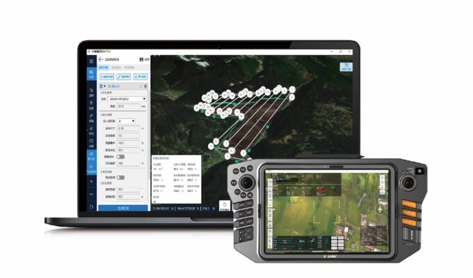
3D Mission Previews of Your Entire Mission Plan
It helps you plan, simulate, and control your drone’s trajectory more accurately for safer flight

Automatic Route Generation Based on Different Gimbal Cameras
The software eliminates the manual workflows and it’s ideal for both beginners and advanced users

AI-based Object Detection and Tracking
It can detect objects while flying and allows the analysis and recording of information on the ground.

Project Real-time Video ontop the 3D map of the Ground Station
This shows the environmental danger and location of the affected area, enhancing people's situational awareness.

Real-time Video Stitching to Generate Orthophotos
2D orthomosaic maps are created simultaneously with the real-time video, providing situational information for security teams.

Live Video Transmission down to 300ms
Transmit 1080P HD live video footage to the ground station via a dedicated data link and allow more officers to see the video from their mobile devices.

More information about JOUAV and our drones
Provide the suitable solution for your needs
Help for your project promotion
Get a product quote