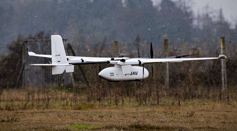
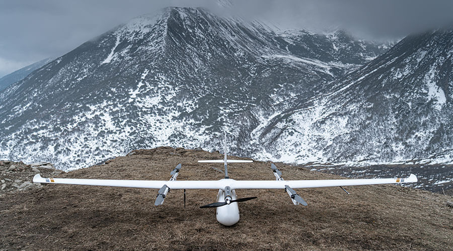
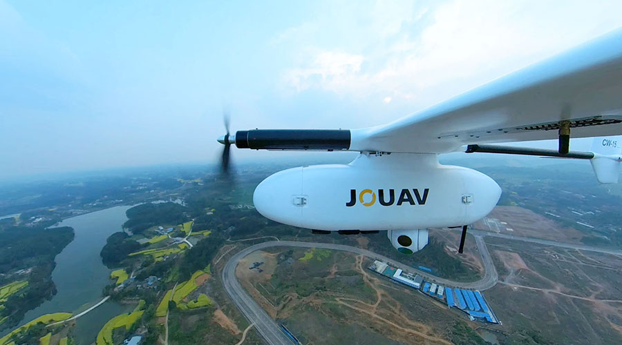
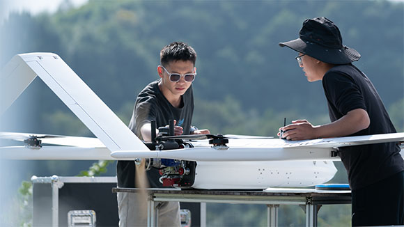
CW-15 Overview
JOUAV CW-15 long-endurance full electric vertical take-off and landing fixed-wing UAV system, which brings the disruptive technology innovation in the UAV industry in flight safety, avionics system, overall machine performance, and operation experience.
Trusted by


Benefits and Features
With the continuous technical updates , our drones bring many actual benefits to our customers, including saving time and cost, getting more comprehensive data, keeping personnel safe, etc.

High Performance
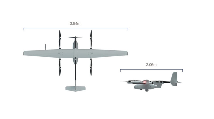
Up to 3 hours endurance, 3kg payloads capability, 4500m take-off altitude, and 6500m practical ceiling. The cruising speed can reach 61km/h.

Multi-purpose
The CW-15 can carry various payloads. Therefore it can be applied to wide range of tasks, including mapping, surveillance, public safety, oil and gas pipeline inspection, etc.

Easy to Use Upgrade
CW-15 is easy to use with its vertical takeoff and landing, auto pre-flight check, magnet compass auto calibration, visualization controller and software, and wireless networking data download.

Active Safety Technology
Automatically avoid obstacles in the flight, detect other drones equipped with ADS-B modules, adapt to more terrain and avoid dangerous landing points such as roofs and cliffs.

Aviation Grade Reliability
Automatically recovery from the fault and balance the abnormal actuation unit. Through the all-digital bus avionics, CW-15 achieves high reliability, high compatibility and strong expandability.

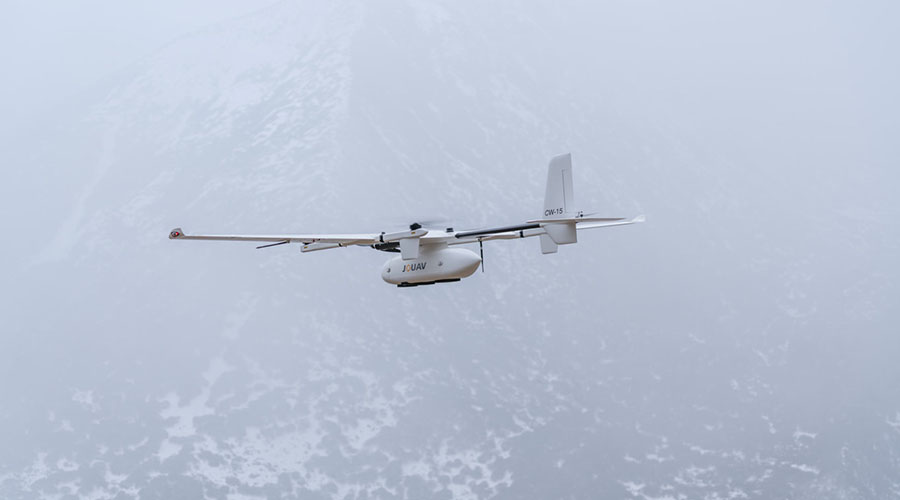
Super Environmental Adaptability
Fly in high altitude, high humidity, low temperature, and light rain condition with self-heating airspeed tube and battery. It can also easily fly in the complex electromagnetic environments.

Open Architecture
Open system architecture and data encryption for private channels means you'll have access to a vanity of industry specific solutions at present and in the future.

Stay updated
We will listen to the feedback from clients and keep updating our products. It keeps our technology at the forefront of industrial drones.
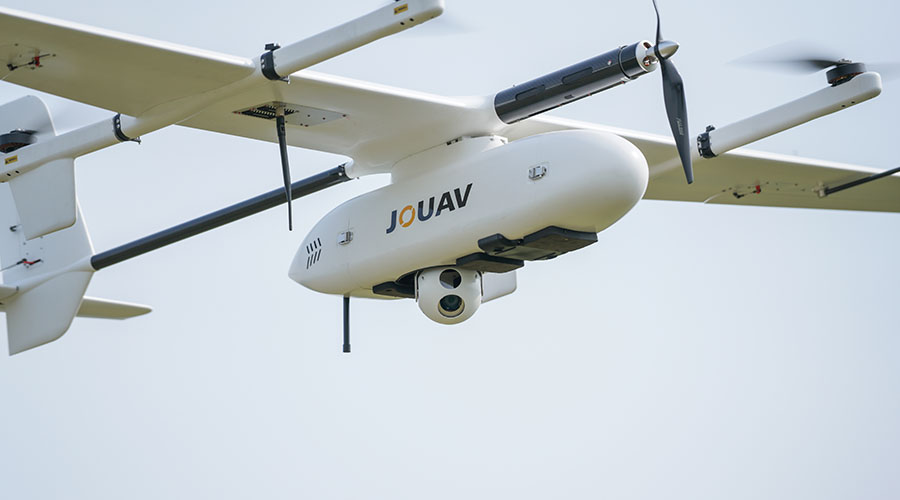
Optional Payloads
JOUAV UAV can carry many types of mission payloads. You can choose different cameras according to the actual mission needs, including LiDAR system, industrial aerial camera, oblique camera system, gimbal system and SAR. Simple and flexible, multi-purpose.
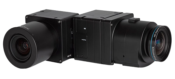
PhaseOne iXM Series Camera
High-resolution medium format cameras for mapping and surveying
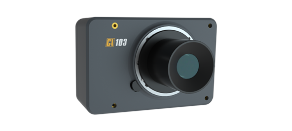
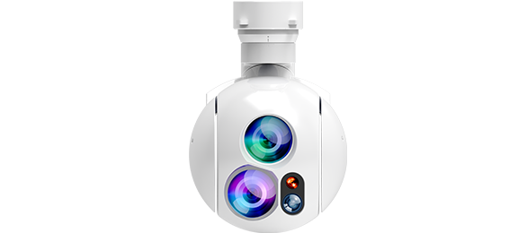
MG-120E EO/IR/LR Gimbal Camera
Lightweight 3-axis 30X optical zoom and thermal imaging with laser rangefinder
Supporting Software
JOUAV provides one-stop UAV products, including the supporting software needed for the task. You can use these software to plan a flight path, control and manage the drone, track and identify targets, and see video and geo-data information from the drone in real time.
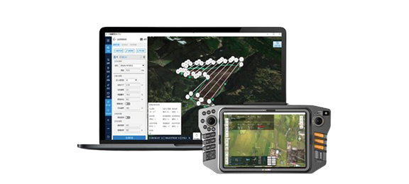
Eagle Map Drone Surveillance Software
An intuitive software solution to deploy drones' security and surveillance operations.
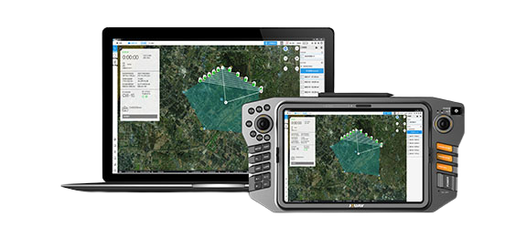
FlightSurv Drone Mapping software
Cloud-based drone mapping software for flight planning, data collection, processing, and analysis.
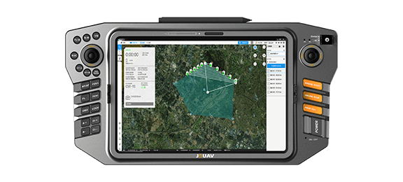
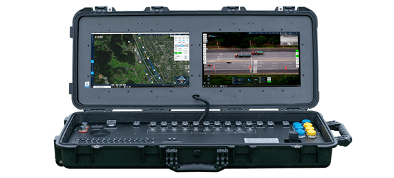
Ground Control Stations
JOUAV offers handheld, portable and modular vehicle ground control station. You can choose different control devices according to the different environment and task.
Professional Technical Support
We are committed to ensuring that every customer can get timely and professional technical support. Engineers can provide customers with remote product installation guidance, software updates, and UAV flight technical support; they can also arrive at the scene to provide services.

Complete drones flight training
Professional after-sales engineer team, online or on-site support
Well documented support and videos
Local distributor support
Worry-free package and professional insurance
Warranty and return to factory repair
More information about JOUAV and our drones
Provide the suitable solution for your needs
Help for your project promotion
Get a product quote