Millions lost, projects delayed: Construction site theft is a costly reality.
According to the National Equipment Register,a staggering $300 million to $1 billion lost annually in stolen construction
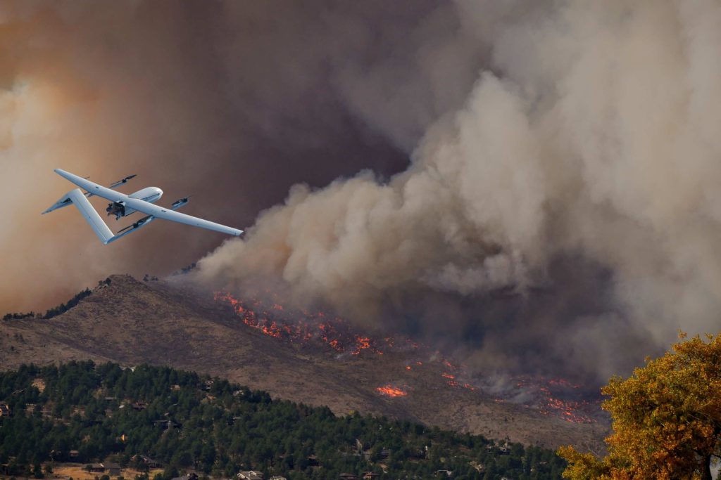
Fires cause devastation worldwide each year, resulting in loss of life, destroyed ecosystems, and ruined communities. In the United States alone, the National Fire Protection Association (NFPA) recorded 3.7 million fires in 2022, causing over 3,700 deaths and $15.5 billion in property damage.
To address this urgent issue, firefighting drones have emerged as a game-changing tool. These aerial marvels, equipped with advanced technology, revolutionize firefighting by enhancing situational awareness, improving safety, and optimizing efficiency.
In this article, we explore the vital role of drones in firefighting, discussing their advantages, success stories, and the top models available.
What are the advantages of drones in firefighting?
These unmanned aerial vehicles (UAVs) offer several advantages that enhance the safety, efficiency, and effectiveness of firefighting operations. In this section, we will explore the numerous benefits of drones in firefighting.
Improved Efficiency and Effectiveness in Firefighting Operations
Public safety drones offer rapid deployment to challenging areas, navigating narrow spaces and flying over obstacles. They can reach heights inaccessible to firefighters, improving response times and containment efforts. Meanwhile, the real-time data they obtain on fire behavior, temperature, and smoke patterns help incident commanders and firefighters adjust their strategies and make informed decisions for more effective firefighting efforts.
Cost-effectiveness and Resource Optimization
Drones offer a cost-effective and efficient alternative to traditional firefighting methods. With fewer personnel needed on the ground and reduced reliance on expensive equipment like helicopters or manned aircraft, drones present a more economical solution. Moreover, drones can operate around the clock, eliminating the need for additional manpower during nighttime operations. By integrating drones into firefighting efforts, significant cost savings can be achieved.
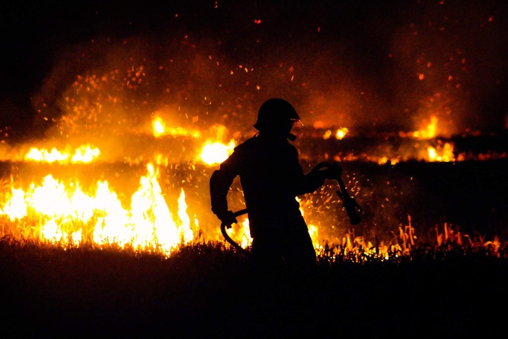
Increased Safety for Firefighters
Drones offer increased safety by reducing firefighters' exposure to hazardous environments. They gather crucial information and assess the situation before firefighters enter, providing valuable insights about fire intensity, structure, and potential dangers.
Equipped with high-resolution cameras and thermal imaging technology, they provide real-time aerial footage and data, enhancing situational awareness for better decision-making regarding firefighting strategies, evacuation routes, and resource allocation. This ensures the safety of both firefighters and affected individuals.
How are Drones Used in Firefighting?
Drones are used in firefighting in various ways to enhance operational efficiency and improve overall safety. Here are some common applications of drones in firefighting:
Aerial Surveillance and Situational Awareness
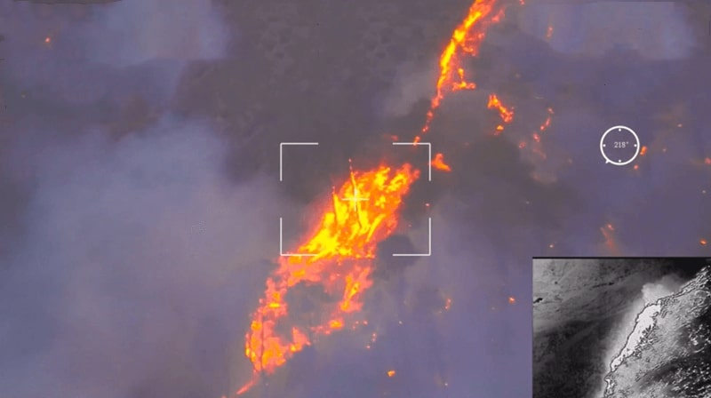
Drones are vital in firefighting operations, providing aerial surveillance and valuable insights to incident commanders. With real-time data and visuals, drones capture the dynamic nature of fires, allowing accurate assessment of size, spread, and behavior. High-resolution cameras on drones help commanders make informed decisions on resource allocation, evacuation, and firefighting strategies.
Additionally, thermal drones detect hotspots and locate trapped individuals. This information helps prioritize efforts, deploy resources effectively, and potentially save lives by identifying those in need of immediate rescue.
Search and Rescue Operations
Drones with thermal cameras can detect heat signatures and provide valuable insights into the location of hotspots and potentially trapped individuals. By capturing thermal images, the drones assist in identifying areas with intense heat and guiding rescue teams to prioritize their efforts effectively.
This technology is particularly beneficial in situations where visibility is limited due to smoke or darkness, enabling search and rescue teams to locate and rescue individuals more efficiently. Thermal drones enhance the overall effectiveness and safety of firefighting search and rescue operations.
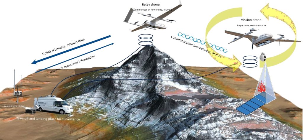
Emergency Communication and Coordination
Aerial firefighting drones also play a crucial role in facilitating communication and coordination among different teams and agencies involved in firefighting operations. In remote or disaster-stricken locations where communication infrastructure might be damaged or non-existent, drones equipped with communication devices can act as relay points.
They establish a network that enables firefighters and other responders to communicate with each other and with the incident command center. This communication capability ensures a smooth flow of information, enhances coordination and improves the overall effectiveness of the firefighting efforts.
Post-Fire Assessment and Recovery
After a fire incident has been contained and extinguished, drones play a vital role in the post-fire assessment and recovery phase. They are deployed to capture aerial imagery and conduct surveys of the affected areas, providing detailed visual documentation of the fire's impact.
By flying over the burnt landscape, drones can create high-resolution point cloud maps and 3D models that help assess the extent of damage to structures, vegetation, and infrastructure. This information is crucial for insurance claims, post-fire investigations, and planning the recovery and restoration process.
Best Drones in Firefighting
In this section, we will list some of the best drones designed specifically for firefighting, highlighting their capabilities and the benefits they bring to fire departments and the overall fire service.
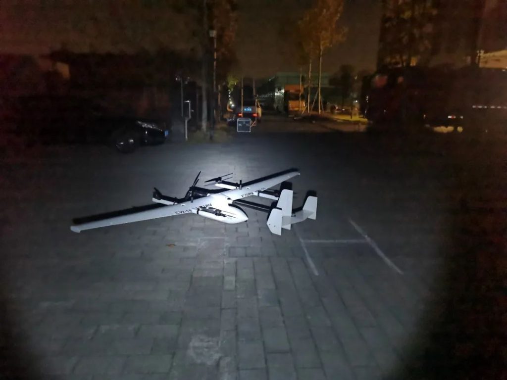
JOUAV CW-15 VTOL - Best Autonomous Fire Fighting Drone
The JOUAV CW-15 is an autonomous drone designed for firefighting operations. It operates without constant manual control, thanks to advanced flight control systems and navigation algorithms. With automated flight paths, takeoffs, landings, and precise waypoint following, it reduces the workload of fire service personnel.
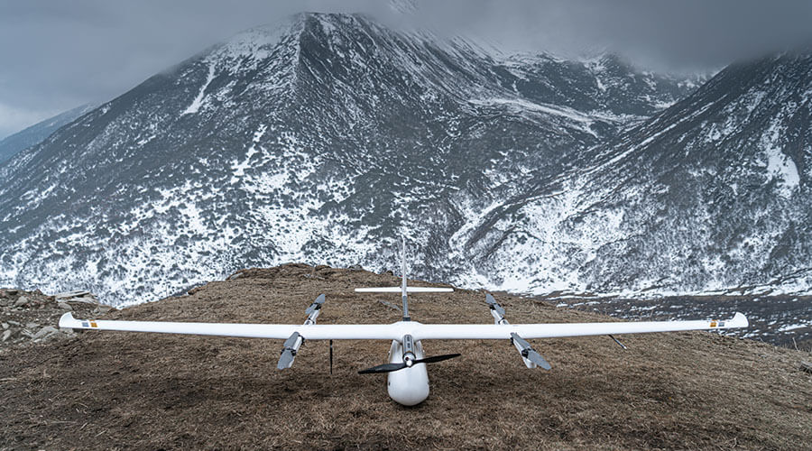
The drone is modular, and portable, and offers a battery life of up to 180 minutes and a 50km flight range. It has a cruising speed of 61.2km/h for quick emergency response. Equipped with the MG-120E payload, including a high-resolution thermal imaging camera and a 30x zoom visible light camera, it helps locate and assess fire points. The drone's open architecture enables seamless processing of video data, image recognition, AI algorithms, and GPU-accelerated computer vision.
- 180 minutes flight time
- 2km/h cruising speed
- 50km transmission and control range
- 3kg payload capability
- 1920x1080 px, 30x zoom camera
- 640x512 px uncooled infrared camera
- AI identification and tracking
- 20°C to 50°C Operating Temperature
- Open SDK
- Obstacle avoidance
JOUAV CW-30E VTOL - Best Long Endurance Drone for Fire Fighting
The JOUAV CW-30E is an oil-electric hybrid drone specifically designed for aerial firefighting missions. Boasting an impressive flight time of up to 480 minutes and a flight range of 200km, this drone offers unparalleled endurance and coverage capabilities. With a cruising speed of 90km/h, it swiftly reaches the scene to aid fire departments in their efforts.
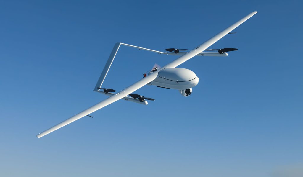
The VTOL drone offers flexible payload options, including the CA-103 61MP aerial camera and the MG-120E dual thermal imaging and multispectral camera. Equipped with high-resolution thermal imaging, a 30x zoom visible light camera, and AI-assisted functions for target identification and tracking, this drone provides precise fire point identification. Additionally, its waterproof design ensures reliability even in light rain, while the mobile take-off and landing function enhances operational convenience.
- 480 minutes flight time
- 90km/h cruising speed
- 200km transmission and control range
- 8kg payload capability
- 1920x1080 px, 30x zoom camera
- 640x512 px uncooled infrared camera
- AI identification and tracking
- 20°C to 50°C Operating Temperature
- Obstacle avoidance
JOUAV PH-7E Quadcopter - Best Fire Search and Rescue Drone
The JOUAV PH-7E quadcopter combines portability with advanced features, making it an indispensable asset for fire departments. Its foldable and lightweight design enables easy transportation and quick deployment in emergency situations. With a battery life of 63 minutes and a flight range of 15km, the PH-7E offers maneuverability in various environments.
Equipped with the PDL-1K thermal imager, a high-resolution infrared detector, a 48 MP zoom camera, and a 1500m laser rangefinder, this drone excels in search and rescue operations. The temperature measurement function and powerful computing capabilities enhance target recognition, motion analysis, and image processing. Additionally, its waterproof design allows for operations in harsh weather conditions.
- 63 minutes flight time
- 8km/h cruising speed (sport mode, horizontal /no wind)
- 15km transmission and control range
- 3kg payload capability
- 4K (3840x2160) visible light camera
- 1280x1024 px thermal camera
- AI identification and tracking
- 20°C to 50°C Operating Temperature
- Obstacle avoidance
Jocloud - Make Smarter Drone Operations in Firefighting
Jocloud is a hardware-independent cloud platform designed to enhance drone operations, particularly in firefighting scenarios. It supports various drone models, such as JOUAV and DJI, enabling users to connect their drones to a cloud-based application.
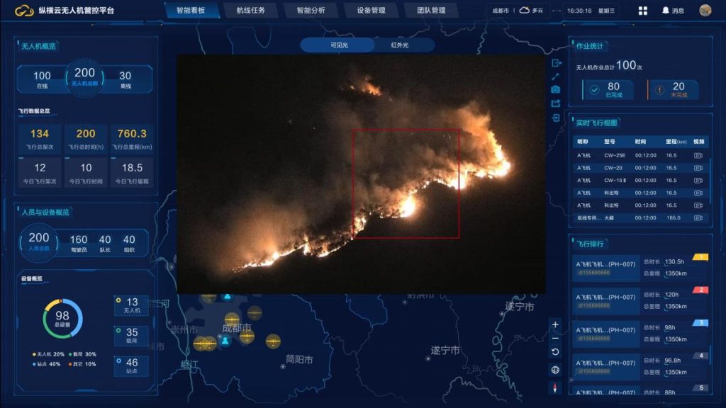
As a standard SaaS product, Jocloud offers ready-to-use functionality for quickly setting up a local command center to manage active drones. Its key features include:
- Web-Based Dashboard: Jocloud provides a user-friendly dashboard integrated with a map interface. This allows operators to control and monitor a fleet of drones from a single location, saving time and reducing costs.
- Real-Time Telemetry and Visual Data: The dashboard displays real-time telemetry and visual data from all connected drones. With dual control from the web dashboard, operators can coordinate UAV operations effectively. Data from multiple drones can be combined and shared, improving situational awareness.
- Dual View Support: If a drone is equipped with an infrared (IR) sensor, Jocloud enables users to switch between RGB and IR views. This feature is especially valuable in post-fire scenarios, where thermal imaging drones can inspect building facades and provide real-time footage to remote structural engineers for better assessment.
- AI Smart Alert: Jocloud facilitates target-specific identification and alerting through its AI capabilities. This enhances the system's ability to detect and respond to critical situations.
- Flight-Report Generation: With Jocloud, generating a comprehensive flight results report is as simple as a single click. This feature streamlines the process of submitting flight reports to higher-level authorities.
- Open API and Customization: Jocloud supports an open API, allowing third-party information platforms to access data within the platform. The platform supports open APIs, facilitating third-party information platform integration through authorized SDK drone access and RTMP protocol Customized function development.
Use Cases of JOUAV Drones in Fire Fighting
Discover two remarkable case studies showcasing the application of JOUAV drones in combating large-scale wildfires in Chongqing and Qinghai, respectively.
CW-15 drone used in Chongqing large-scale wildfires
Chongqing, a mountainous region in southwestern China, faced a severe wildfire outbreak in the summer of 2022. To combat these fires, local authorities deployed the JOUAV CW-15 drones equipped with advanced thermal imaging cameras.
The CW-15 drones flew at low and medium altitudes and monitor the key forest prevention areas. The video footage collected by the drone will be transmitted back to the ground center in real time for data analysis and decision-making.
Click to read more about the case study
CW-007 and CW-15 used in the Qinghai wildfire
A forest fire broke out in Qinghai Province, China, and threatened to spread across vast areas, endangering local communities and wildlife. JOUAV responded by deploying a combination of CW-007 and CW-15 drones to combat the blaze.
Read More

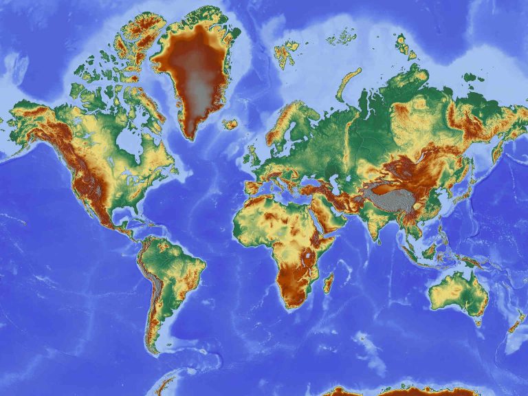
Have you ever wondered why Greenland appears larger than South America on a world map? This is a prime example of map distortion, a necessary consequence of transforming our spherical Earth onto a fla
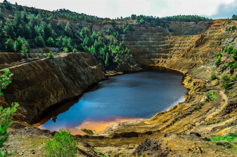
Our modern world relies on hidden resources – the metals in our phones, the minerals in buildings, and the coal that once powered our societies. However, extracting these materials has an environmenta

JOUAV Product News and Use Cases
Fixed-Wing VTOL Drones Insights and Industry Trends
Invitations to online demo events